


The BioRev-Aix project (for biodiversity and street network in Aix-en-Provence), funded by the French Ministry of Ecological Transition as part of the Biodiversity, Urban Planning and Morphology (BAUM) program, initiated in 2019 by the Plan Urbanisme Construction Architecture (PUCA), set out to question the street's capacity to support urbanistic and ecological functions. In this context, the network of urban streets and lanes was considered as a support not only for a diversity of human uses and appropriations, but also for the blossoming of the ecological dynamics of habitat and dispersion.
Reading time: 4 minutes
Crossing urban planning and ecology, this research used the "street section" as an original unit of analysis to model urban morphology and question its biodiversity.
The "street section" corresponds to a linear urban thoroughfare (excluding roads and footpaths) included between two intersections, and to which a buffer zone of 30 m on either side of its central axis has been applied.
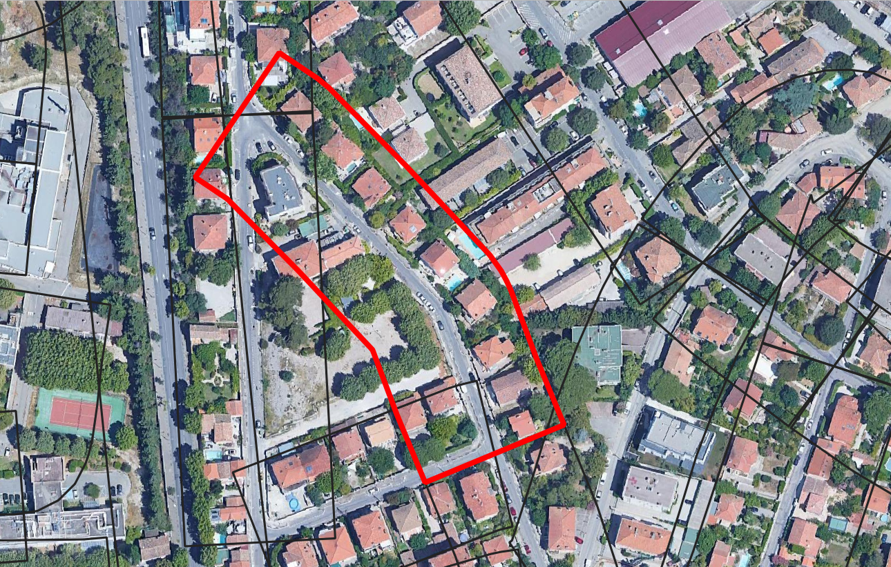
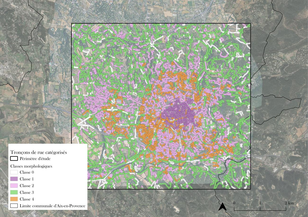
On which stretches should trees be planted?
A set of 5,460 stretches, classified into 5 contrasting morphological types, was thus generated for the study area, the perimeter of which focuses on the city center and the inner suburbs of Aix-en-Provence.1
The next step was to consider the stretch as part of an interconnected road network. To this end, the work focused on identifying street sections where it would be theoretically more relevant to plant trees in order to improve ecological connectivity on a territorial scale.
In practice, this modelling approach was based on the simulation of the increase in the area of habitat reachable by the red squirrel. This common species of arboreal rodent was chosen for its propensity to use the trees of the road network as vectors of movement through the city.
By integrating scientific knowledge on the dispersal distances specific to this species, a decision-support algorithm was then developed2. For its application, the choice was made to use a hexagonal tiling of the city, a shape that best preserves the distances between two points in space. The study area was then paved with 688401 hexagons with sides of 3.77 m (37 m²).
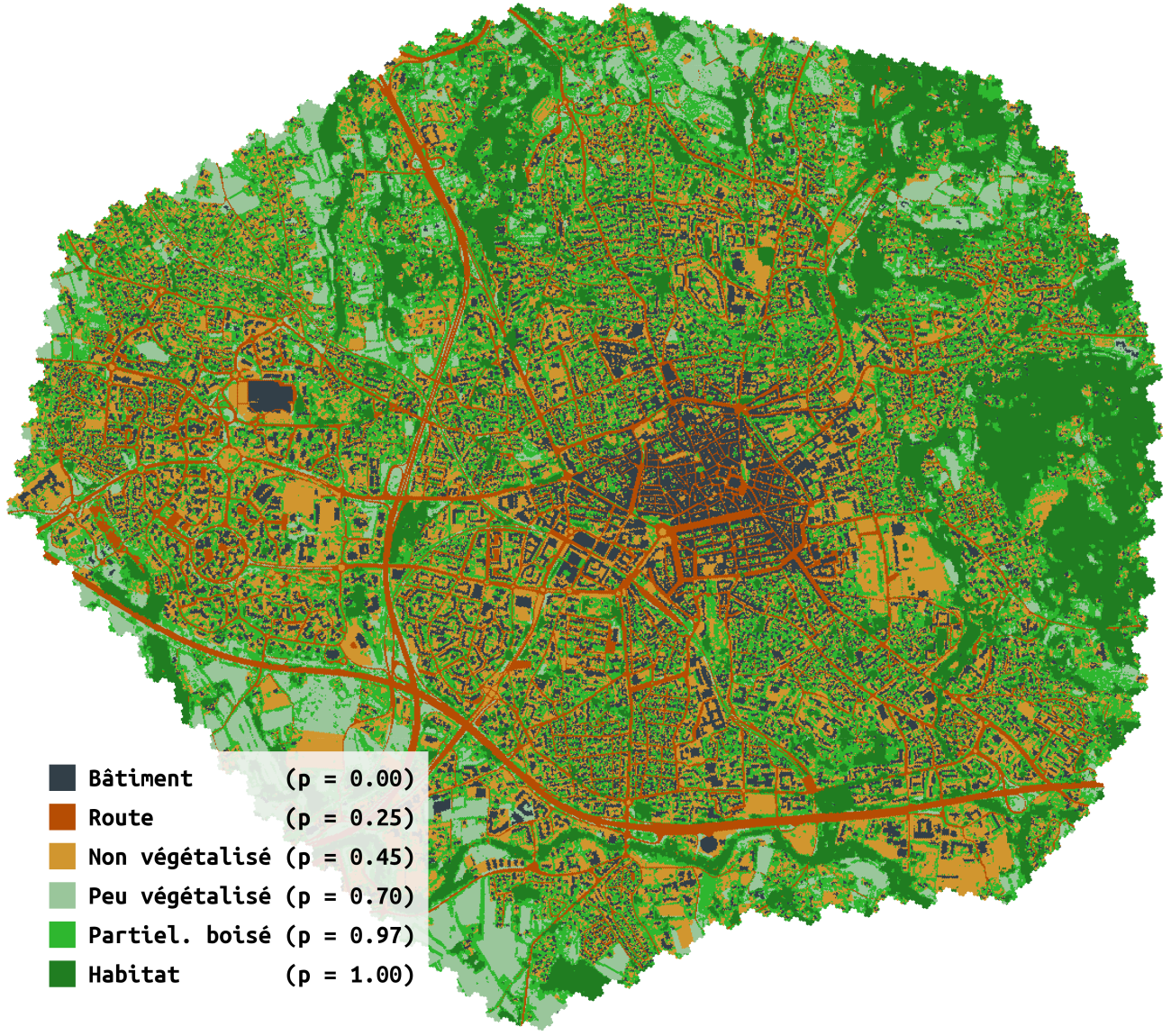
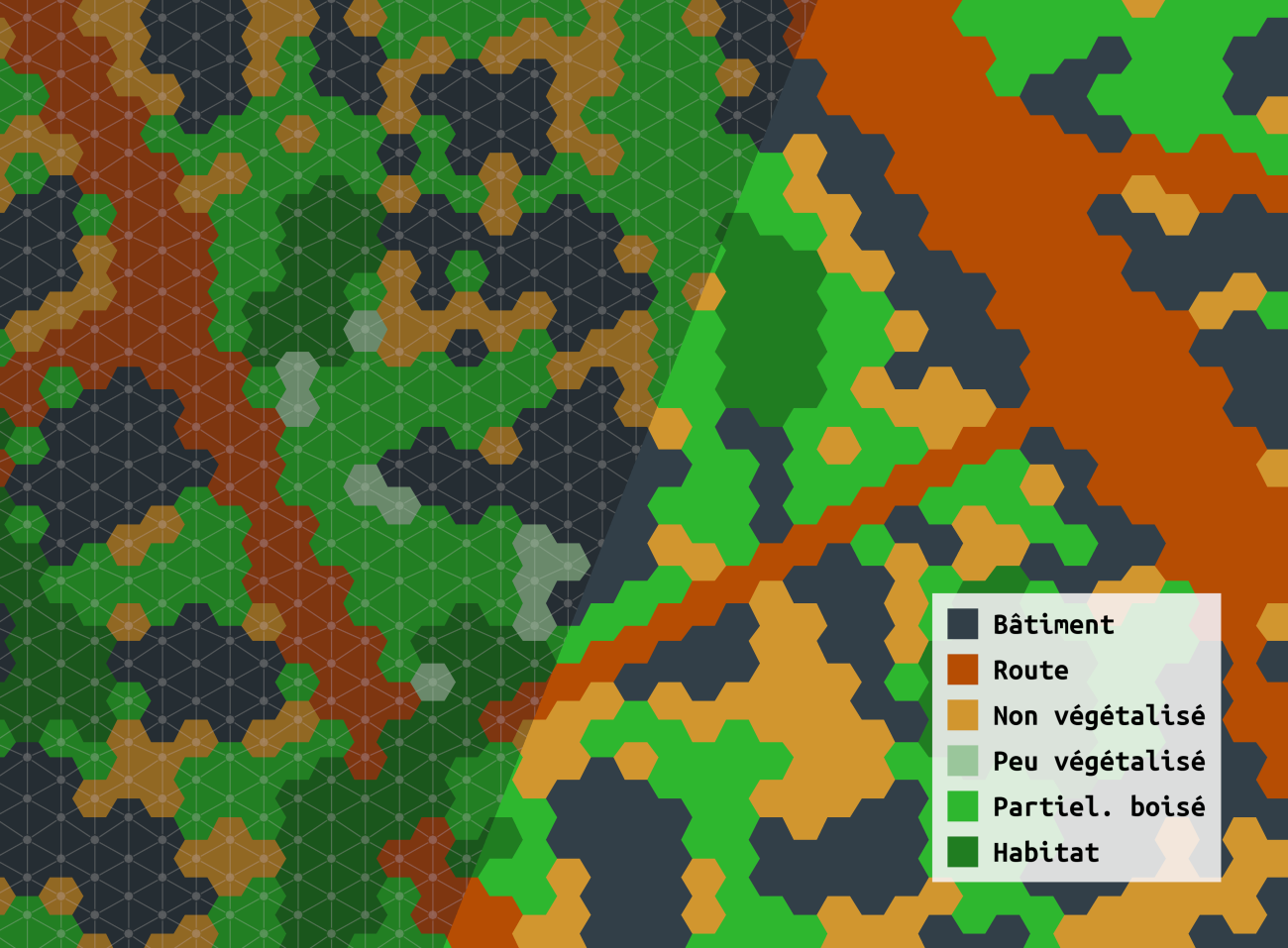
When city and nature intertwine
Depending on the level of its tree surface, each hexagon was associated with a habitat potential as well as a connection probability. The importance of different street sections and their potential contribution to the overall connectivity of the red squirrel's landscape graph was tested.
The application of this optimization algorithm led to the identification of a set of 1569 street sections where planting tree alignments could improve the ecological connectivity of canopies, and thus promote squirrel movements in the city. Spatializing these potential sections highlights the importance of city-nature bangs and periphery-to-periphery links.
This means that urban greening initiatives should not be seen simply as a means of compensating for the mineral nature of central areas, but also as a source of interpenetration between city and nature.
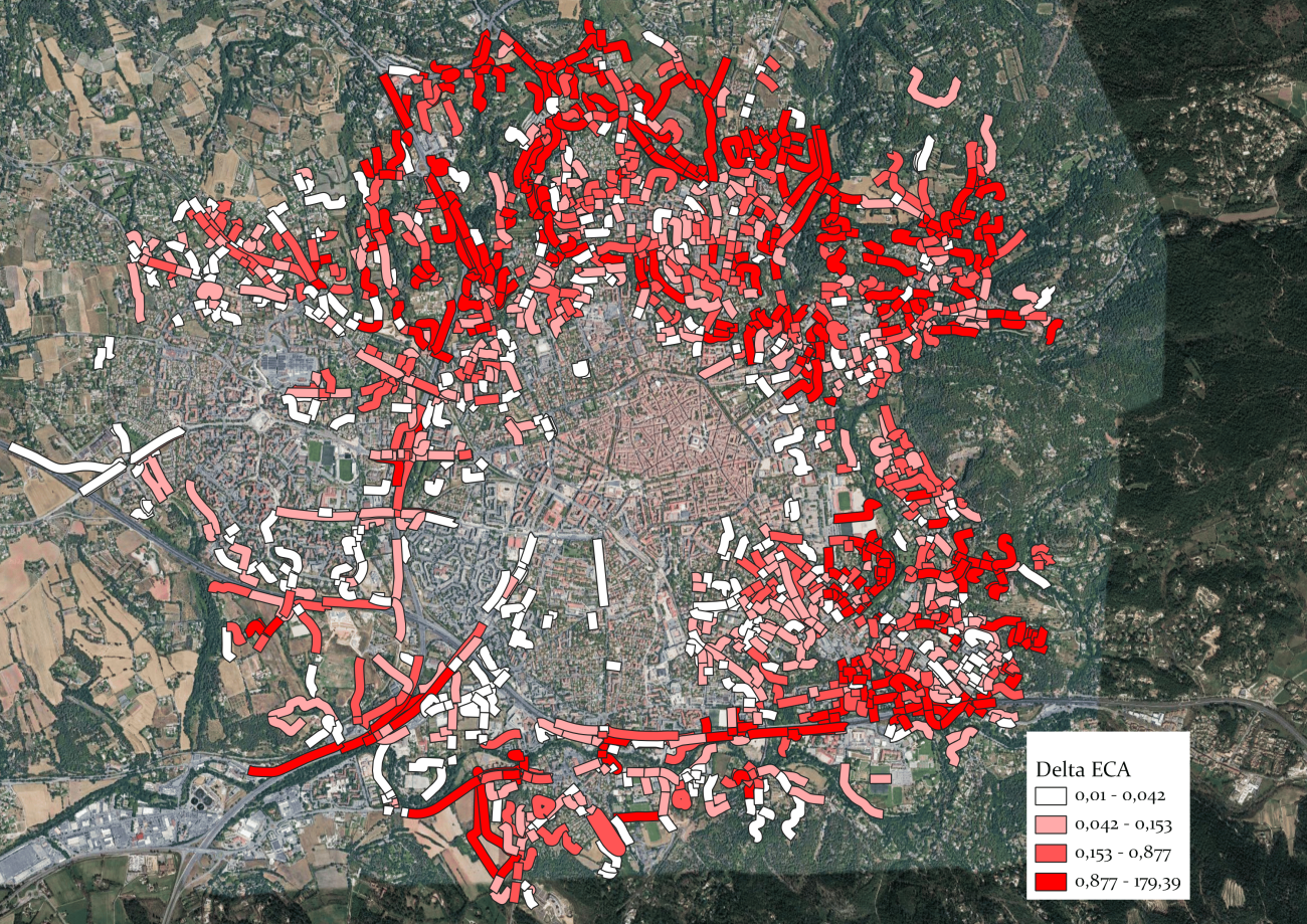
Selection of street sections where densification of the ecological network could be most effective from the squirrel model's point of view.
On the trail of the red squirrel
These results are now being tested in the field, with the implementation of GPS tracking and population genetics analyses on red squirrels in the city of Aix-en-Provence, to identify potential barriers to movement for this species in natura.
This work has also contributed to the development of an innovative decision-support tool made available to the city of Aix's partners to support the implementation of its road network revegetation policy.
The tool, called GECOT for Graph-based Ecological Connectivity Optimization Tool, has now evolved to take into account the cumulative effects of revegetation actions on habitat connectivity, enabling the combination of sections to be revegetated leading to the greatest increase in attainable habitat area3.
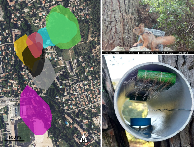
Monitoring the movements and genetic flows of red squirrels in the city of Aix-en-Provence.⁴
Contact à ajouter
Contact à ajouter
Contact à ajouter
Contact à ajouter
References :
- Romeyer B., Montel N., Pham M., Consales J N, 2024, " Appréhender la nature en ville à travers le tronçon de rue : une double approche méthodologique et projetuelle du cas d'Aix-en-Provence ", in Bonneau E., L'urbanisme en transition : écologisation et coopérations, Presses universitaires de Bordeaux, pp.49-74.
- Hamonic, F., Couëtoux, B., Vaxès, Y., Albert, C. 2023, Cumulative effects on habitat networks: How greedy should we be?Biological Conservation, 282, 110066.
- Hamonic, F., Vaxès, Y., Couëtoux, B., Albert, C, 2025, GECOT: Graph-based Ecological Connectivity Optimization Tool. Methods in Ecology and Evolution (in press).
- Figure linked to the ERC SCALED project (ERC STG 949812) - More information on the project: https://www.scaled-erc.eu/
Photo credit: Natalija Mislevicha on Pexels.
Article published Tuesday July 8, 2025.
Discover also


Share on social media or